Rečyca (Rechytsa)
 |
 |
Rechytsa is one of the oldest towns in Belarus. First settlements in this region are dated back to the epoch of mesolite (9 – 5th centuries B.C.). Later, this area was inhabited by the Dregovichi tribe. The town was first mentioned in the Novgorod chronicle in 1213 as a town of the Principality of Chernigov. Rechytsa was also ruled by Kiev and Turov Grand Dukes. At the time of Gediminas reign (1311–1341) the town was annexed to the Grand Duchy of Lithuania, from 1385 forming part of the Polish–Lithuanian union. Rečyca as well as Orsha, Shklow, Mogilev, Stary Bychaw and Rahachow formed a well-developed frontier defense system at the River Dniepr.
1392–1430 – the reign of Grand Duke Vytautas. He constructed a fortified castle with five towers in the area of the detinets (old Belarusian for the downtown) on the bank of the Dniepr. At that time the town had three fortification lines in the form of water trenches and ramparts with bastions. In the area between the fortress and the second fortification line there was a territory for rich mansions, Church of the Order of Friars Preachers and a trade square. The town inhabitants settled lived between the second and third fortification lines. The construction of the town had clear right-angled forms.
In 1561 the town was partially granted Magdeburg rights by Sigismund II Augustus. Within the Polish–Lithuanian Commonwealth, it was a county seat in the Minsk Voivodeship. The town was practically destroyed during the Cossack war of 1648–1651. After the Truce of Andrusovo it was restored to the Polish–Lithuanian Commonwealth. It was annexed by Russia in the Second Partition of Poland in 1793. It then became an uyezd seat in the newly formed Minsk Governorate.
The first permanent town plan of Rechytsa was approved in 1800. During the Napoleonic Wars in 1812 the town was a temporary residence of the Minsk governor. The town was occupied by Napoleon's Army in some of 1812, fought over by Whites and Reds during the Russian Civil War of 1917–1922, occupied by Central Powers in 1917–1918, and temporarily controlled by Poland in 1920 during the Polish–Soviet War. From 1922 it formed part of the Soviet Union. It was under German occupation during World War II in 1941–1943/4. The Germans operated a Nazi prison in the town.
Map - Rečyca (Rechytsa)
Map


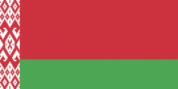
Country - Belarus
 |
 |
| Flag of Belarus | |
Until the 20th century, different states at various times controlled the lands of modern-day Belarus, including Kievan Rus', the Principality of Polotsk, the Grand Duchy of Lithuania, the Polish–Lithuanian Commonwealth, and the Russian Empire. In the aftermath of the Russian Revolution in 1917, different states arose competing for legitimacy amid the Civil War, ultimately ending in the rise of the Byelorussian SSR, which became a founding constituent republic of the Soviet Union in 1922. After the Polish-Soviet War, Belarus lost almost half of its territory to Poland. Much of the borders of Belarus took their modern shape in 1939, when some lands of the Second Polish Republic were reintegrated into it after the Soviet invasion of Poland, and were finalized after World War II. During World War II, military operations devastated Belarus, which lost about a quarter of its population and half of its economic resources. The republic was redeveloped in the post-war years. In 1945, the Byelorussian SSR became a founding member of the United Nations, along with the Soviet Union.
Currency / Language
| ISO | Currency | Symbol | Significant figures |
|---|---|---|---|
| BYN | Belarusian ruble | Br | 2 |
| ISO | Language |
|---|---|
| BE | Belarusian language |
| RU | Russian language |